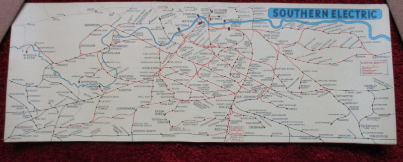
London Railway Map Carriage Print. Southern Electric
Book Description
London Railway Map Carriage Print. Southern Electric. A Southern Railway London area map on stiff card, size 65 by 24 cm., originally intended to show the company’s suburban routes inside a carriage in a display panel above the seats. Colour. Covers an area from Slough and Windsor across to Dartford in the north (and including London main line stations) and from Farnham across to Tonbridge in the south. No date but lettering and style would appear to indicate the period 1935-55. VG condition.
Author
Southern Electric
Date
1950
Publisher
Southern Electric
Illustrator
Unknown
Condition
VG
Other books
If you liked the book you've just seen, you might be interested in other books from the same dealer below.
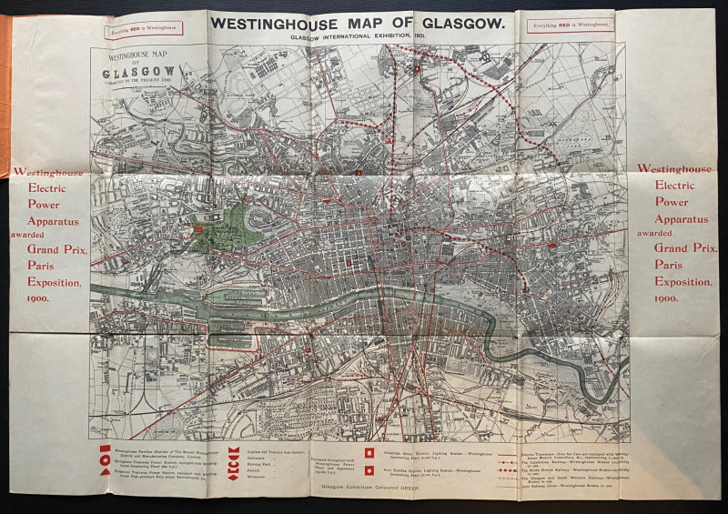
The Westinghouse Map of Glasgow: Glasgow Internati...
Anon
Westinghouse
£100.00
Offered by Arthur Hook
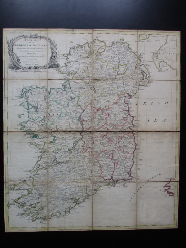
A New Map of the Kingdom of Ireland Divided into i...
Bayly
Carrington Bowles
£325.00
Offered by Arthur Hook
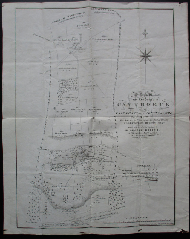
Plan of the Lordship of Caythorpe in the East Ridi...
Madeley
Madeley
Reserved
Offered by Arthur Hook
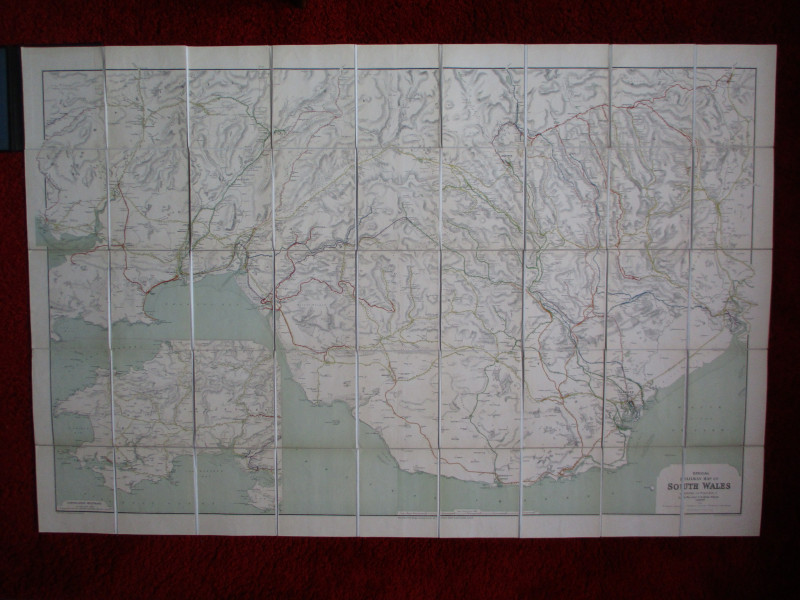
Railway Clearing House Map of South Wales 1926
Emslie
Railway Clearing House
£125.00
Offered by Arthur Hook
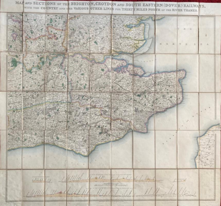
Map and Sections of the Brighton, Croydon and Sout...
Jobbins
Jobbins
£275.00
Offered by Arthur Hook
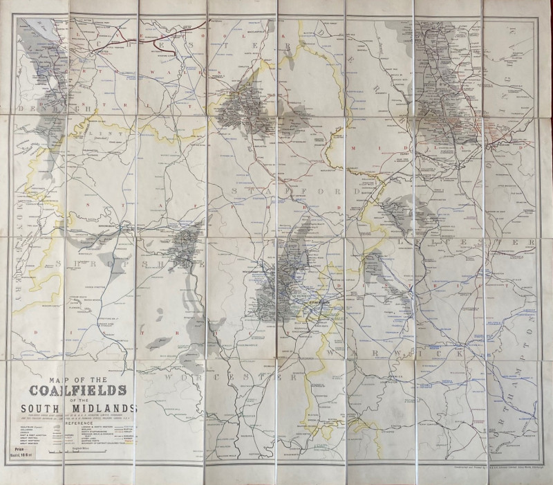
Map of the Coalfields of the South Midlands circa...
Johnston
Johnston
£100.00
Offered by Arthur Hook
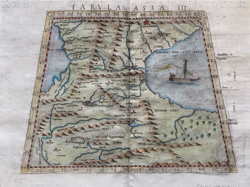
Ptolemy Map of the Caucasus Region: Armenia and pa...
Ptolomey
Pirckheimer
£85.00
Offered by Arthur Hook
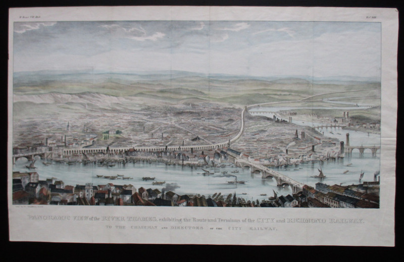
Panoramic View of the River Thames exhibiting the...
Schulthess
City and Richmond Railway
£310.00
Offered by Arthur Hook
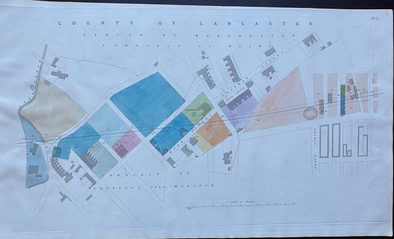
Enlarged plan of Central Manchester with the Penit...
Rennie
Arrowsmith
£70.00
Offered by Arthur Hook
Friends of the PBFA
For £10 get free entry to our fairs, updates from the PBFA and more.
Please email info@pbfa.org for more information