Davies’ New Map of London and its Environs showing the New Railways, Stations, and other Improvements.


Book Description
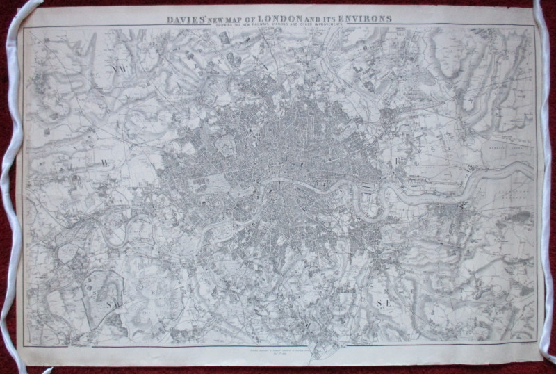
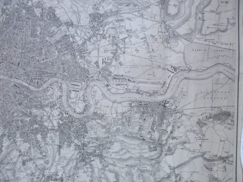
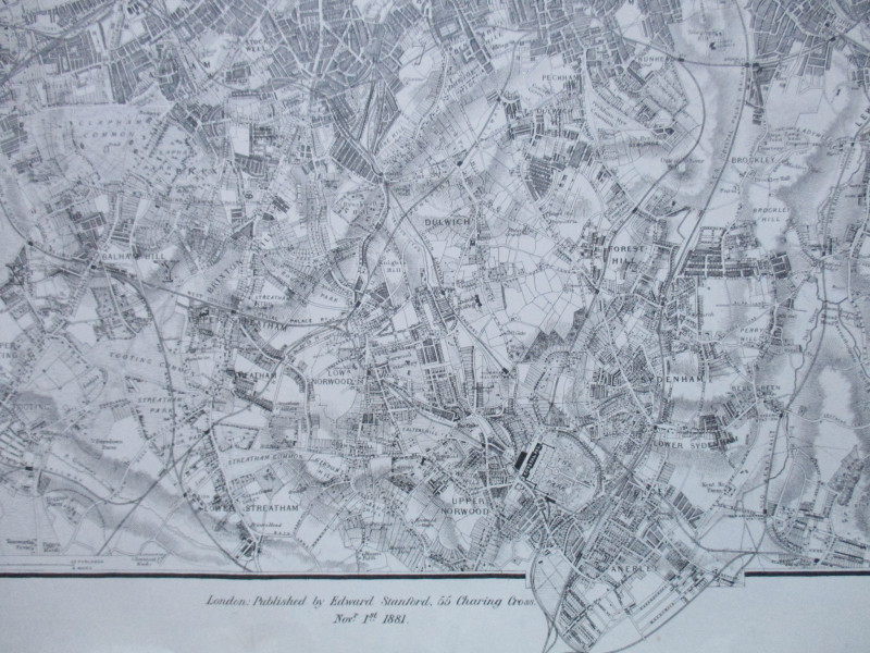
Davies’ New Map of London and its Environs showing the New Railways, Stations, and other Improvements published by Stanford, London November 1st 1881. On paper size 102 by 76 cm. Scale two inches to the mile. Uncoloured. Covers an area from Kenton in the north west across to Hainault Forest and from Teddington to Foots Cray in the south. Shows all railways and stations. A detailed map in Good condition. Has been rolled. Minor edge nicks outside the margins of the map and two closed tears to the edge repaired with clear archival tape to the reverse
Author
Davies
Date
1881
Publisher
Stanford
Illustrator
Davies
Condition
Good
Other books
If you liked the book you've just seen, you might be interested in other books from the same dealer below.

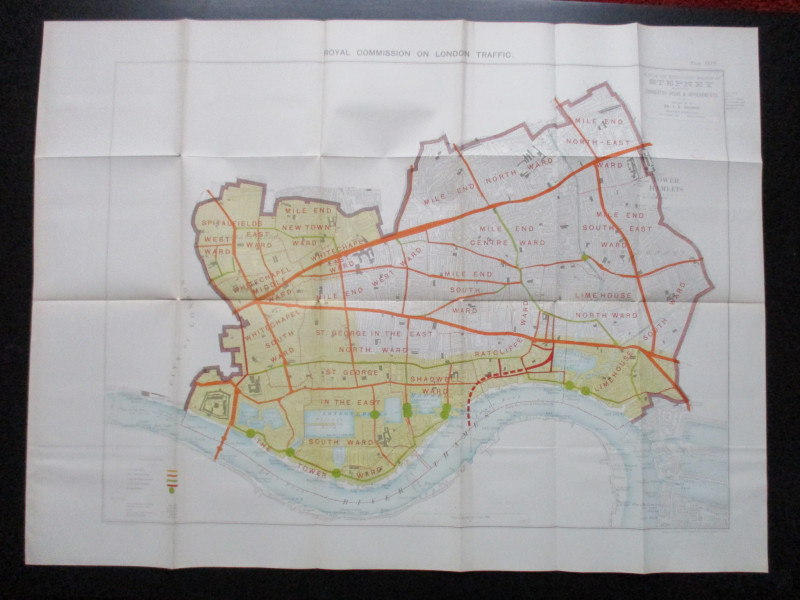
Plan of the London Metropolitan Borough of Stepney...
Ordnance Survey
Hansard
£45.00
Offered by Arthur Hook
Ordnance Survey map of City of London (part) with...
Yelland
Ordnance Survey
£55.00
Offered by Arthur Hook
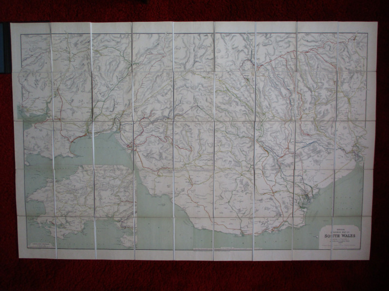
Railway Clearing House Map of South Wales 1926
Emslie
Railway Clearing House
£125.00
Offered by Arthur Hook

Friends of the PBFA
For £10 get free entry to our fairs, updates from the PBFA and more.
Please email info@pbfa.org for more information