Two Maps of Charing Cross so displayed that the Changes caused by the Construction of Trafalgar Square may be conveniently studied
Book Description
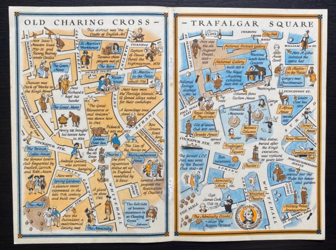
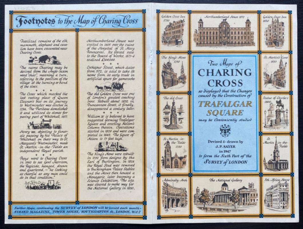
Two Maps of Charing Cross so displayed that the Changes caused by the Construction of Trafalgar Square may be conveniently studied devised and illustrated by J P Sayer, published by the Strand Magazine London circa 1948.The reverse has “Footnotes to the Map of Charing Cross” and the title surrounded by images of the important buildings in the area. Has been folded. The centre of the fold between the two maps has the evidence of closed holes from a binding in two places. Good condition.
Author
Sayer
Date
1948
Publisher
Strand Magazine
Illustrator
Sayer
Condition
Good
Other books
If you liked the book you've just seen, you might be interested in other books from the same dealer below.

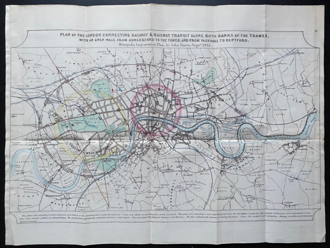
John Martin's Plan for the London Connecting Railw...
John Martin
Hansard
£650.00
Offered by Arthur Hook
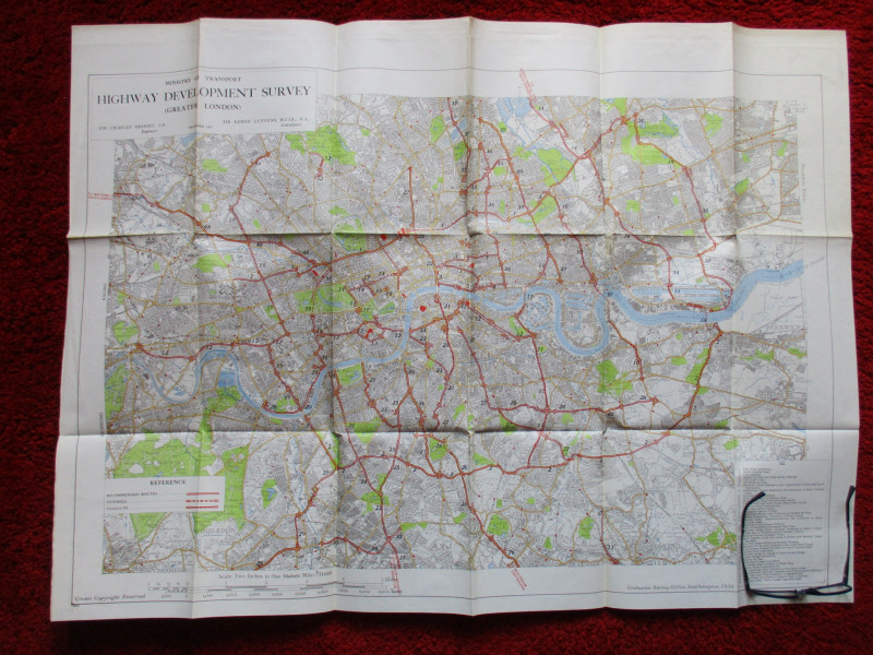
Ministry of Transport Highway Development Survey 1...
Bressey & Lutyens.
HMSO
£90.00
Offered by Arthur Hook
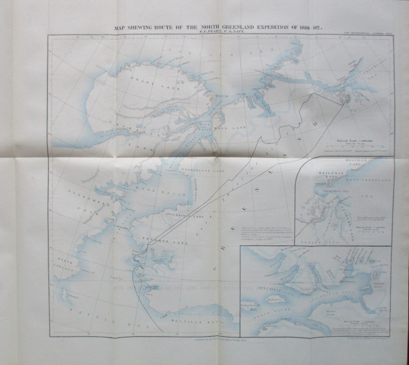
Map Shewing Route of the North Greenland Expeditio...
Peary
Royal Geographical Society
£55.00
Offered by Arthur Hook
Friends of the PBFA
For £10 get free entry to our fairs, updates from the PBFA and more.
Please email info@pbfa.org for more information