A New Map of England and Wales projected from the Trignometrical Operations made for the General Survey of the Kingdom
Book Description
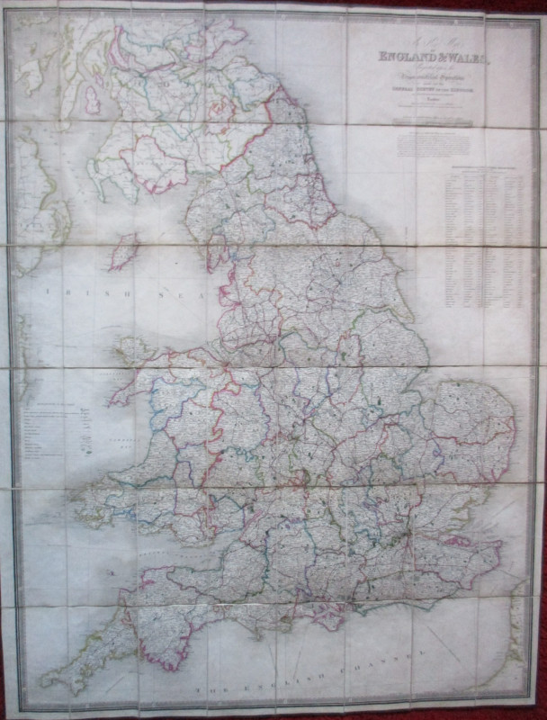
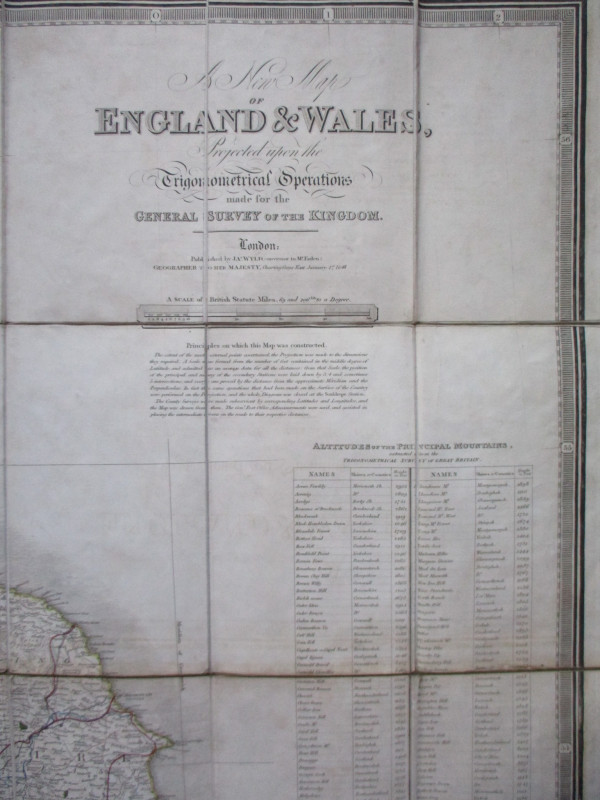
A New Map of England and Wales projected from the Trignometrical Operations made for the General Survey of the Kingdom by J Wyld, Geographer to Her Majesty, January 1846. Published by Wyld, London 1846. On folding linen in 48 sections, size 127 by 98 cm. Scale ten inches to the mile. Hand-coloured. With a key to features such as roads, cities, parishes, villages, railways, turnpikes, navigable canals etc. and with a panel of information on the altitude of the principal mountains. Folds into what is probably the original slipcase. VG condition
Author
Wyld
Date
1846
Binding
Map on linen with slipcase
Publisher
Wyld
Illustrator
Wyld
Condition
VG
Other books
If you liked the book you've just seen, you might be interested in other books from the same dealer below.
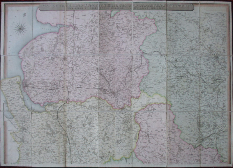
Map of the Grand Junction Railway and Adjacent Cou...
Cheffins
Cheffins
£350.00
Offered by Arthur Hook
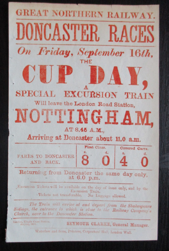
Doncaster Races by Great Northern Railway 1870
Anon
Great Northern Railway
£45.00
Offered by Arthur Hook

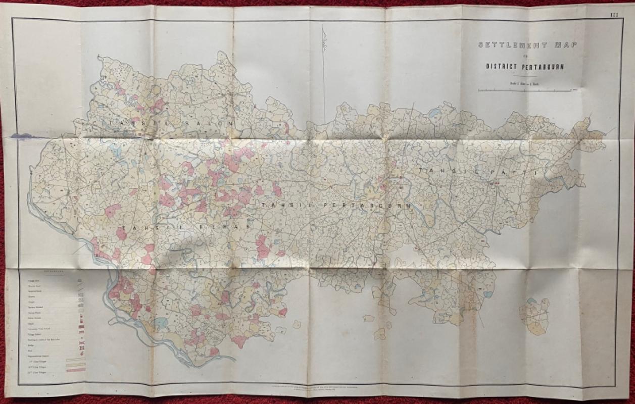
Settlement Map of District Pertabgurh (Pratapgarh...
Survey of India
Survey of India
£100.00
Offered by Arthur Hook
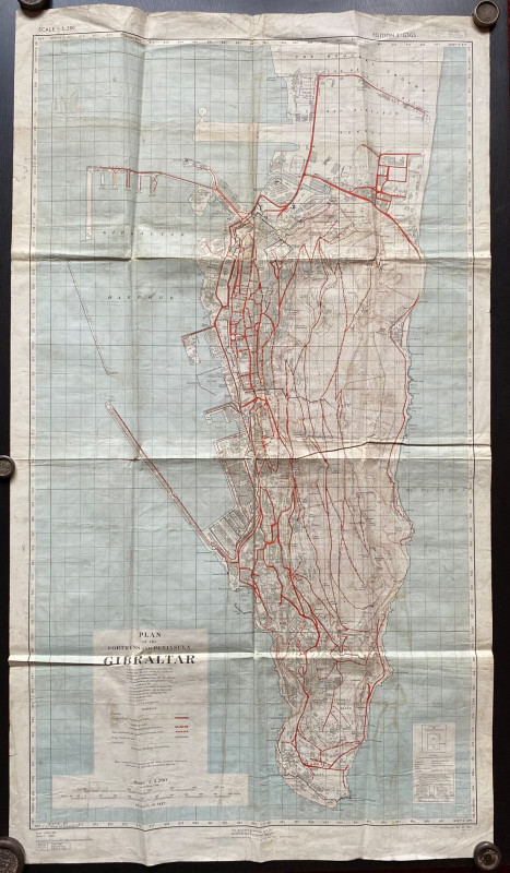
Plan of the Fortress and Peninsula of Gibraltar
British War Office & Air Ministry
British War Office & Air Ministry
£135.00
Offered by Arthur Hook
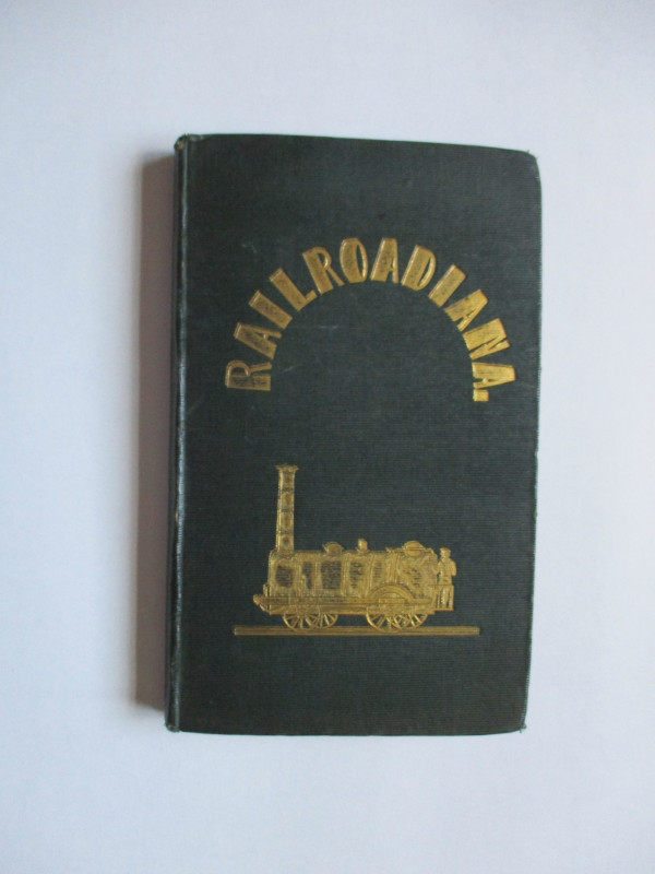
Railroadiana : A New History of England or picture...
Anon
Simpkin Marshall
£250.00
Offered by Arthur Hook
Friends of the PBFA
For £10 get free entry to our fairs, updates from the PBFA and more.
Please email info@pbfa.org for more information