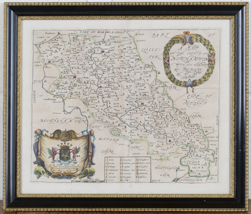
A Mapp of the County of Northampton with its Hundreds
Book Description
Other books
If you liked the book you've just seen, you might be interested in other books from the same dealer below.
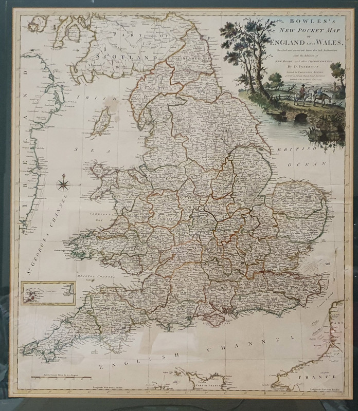
Bowles's New Pocket Map of England and Wales
Daniel Paterson, 1738-1825, cartographer
Carington Bowles
£375.00
Offered by Alastor Rare Books
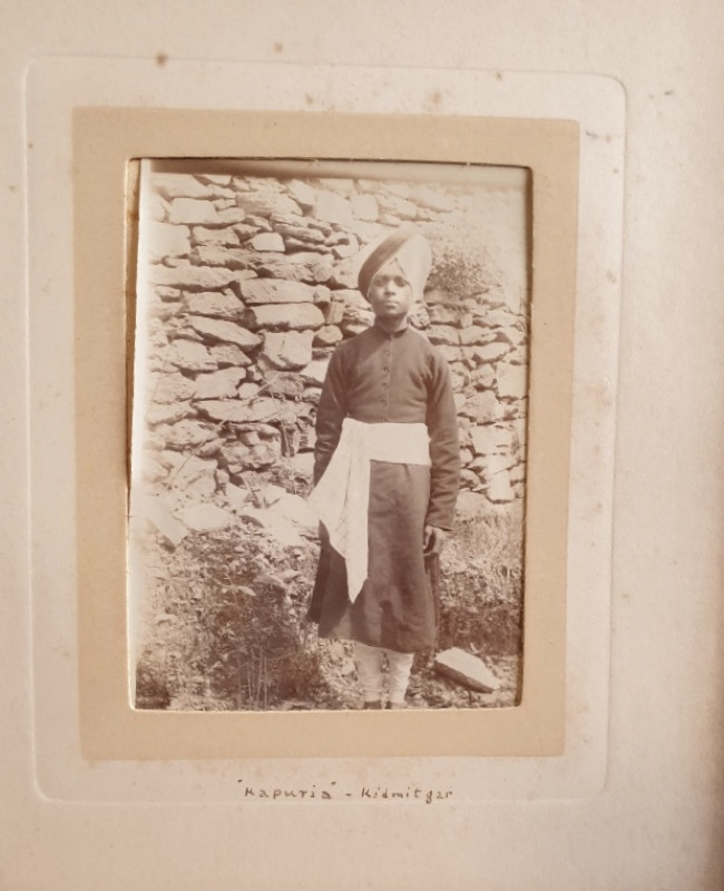
[Album Of Photographs titled “Photographs Taken At...
[Shimla, India]
£60.00
Offered by Alastor Rare Books
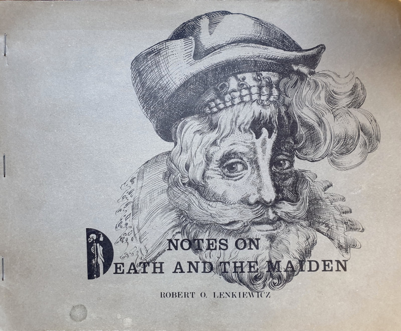
Notes On Death And The Maiden.
[ARTISTS BOOK]. Lenkiewicz, Robert.O.
[Plymouth, England]: [By the author],
£150.00
Offered by Alastor Rare Books
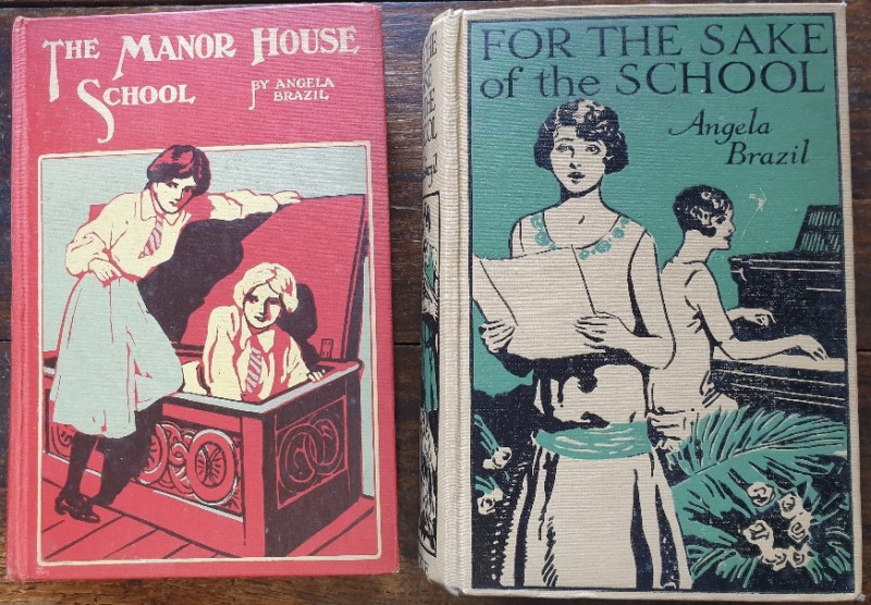
For The Sake Of School [And] The Manor House Schoo...
Brazil, Angela.
London & Glasgow: Blackie.
£25.00
Offered by Alastor Rare Books
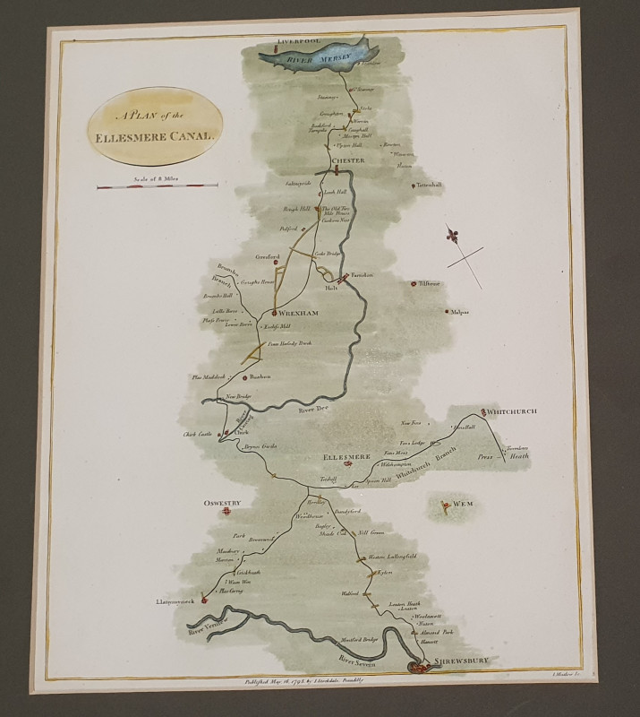
CANANL MAP: Plan of the Ellesmere Canal
Joseph Mutlow
John Stockdale, London
£75.00
Offered by Alastor Rare Books
[AN ELIZABETHAN PROPERTY DOCUMENT - 1573].
[Final Concord Counterpart Property Conveyance For Property In Sutton].
£120.00
Offered by Alastor Rare Books
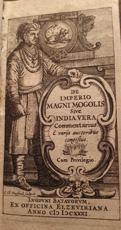
[A POCKET 17TH C HISTORY OF INDIA BY THE DIRECTOR...
De Laet, Joannes. De Imperio Magni Mogolis Sive India Vera Commentarius....
Lvgdvni Batavorvm i.e. Leiden:Ex Officina Elzeviriana,
£140.00
Offered by Alastor Rare Books
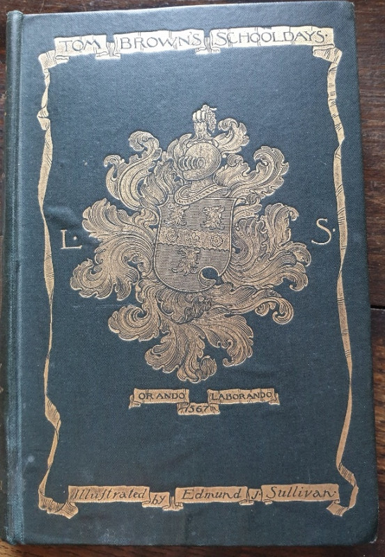
Tom Brown's School-Days.
Hughes, Thomas.
London: Macmillan And Co. Ltd.
£18.00
Offered by Alastor Rare Books
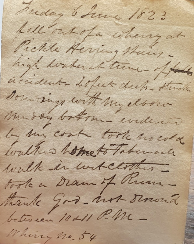
[Short, B].
[Miniature Manuscript Commonplace Book & Diary].
[London]:
£80.00
Offered by Alastor Rare Books
Friends of the PBFA
Please email info@pbfa.org for more information