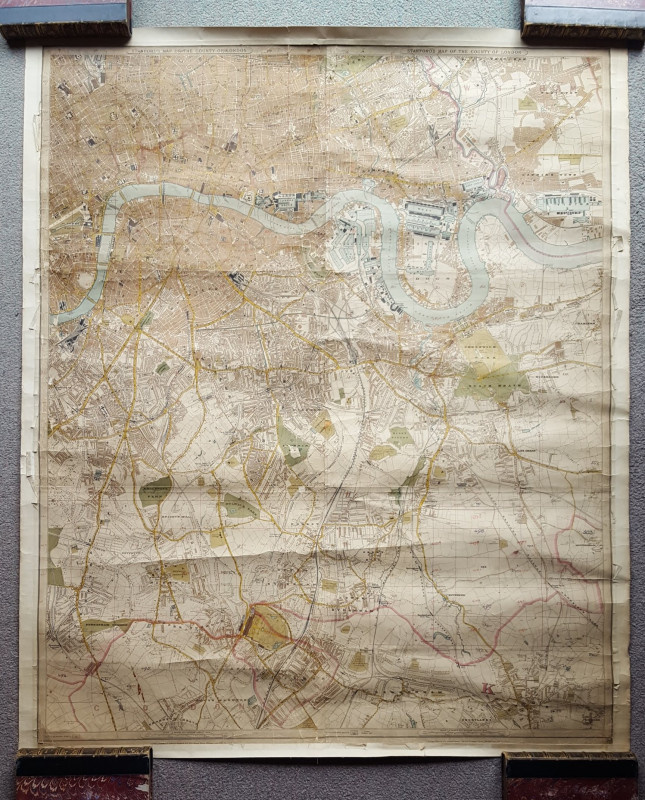
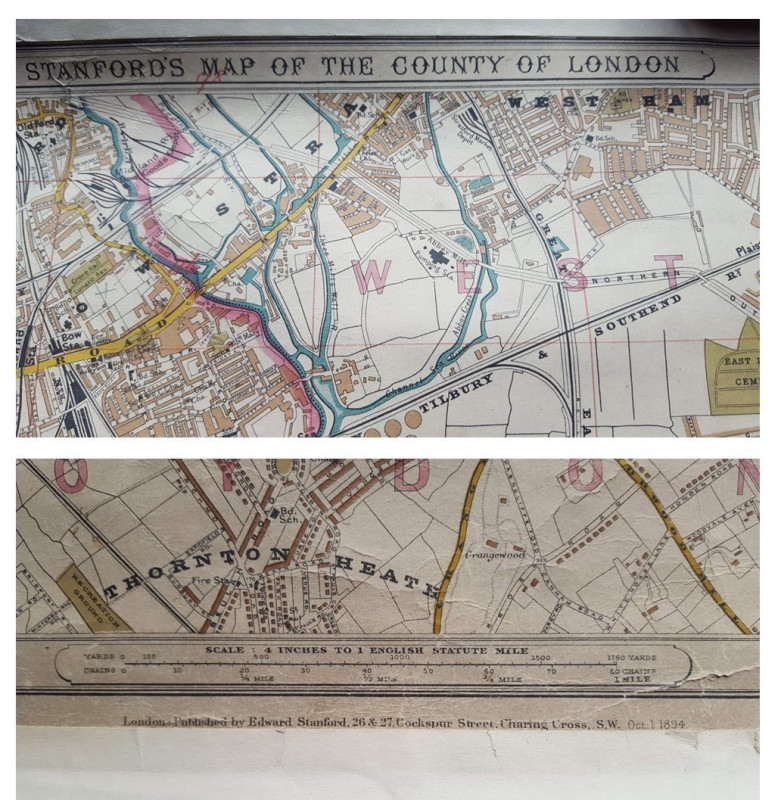
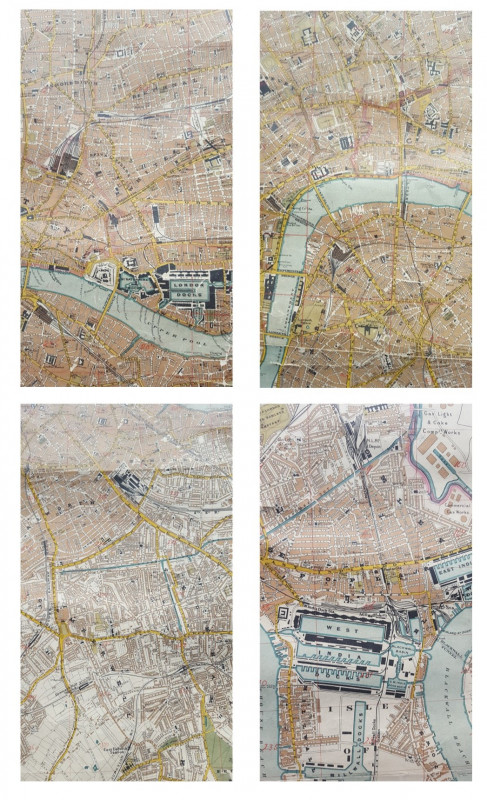
STANFORD’S MAP OF THE COUNTY OF LONDON


Book Description
Other books
If you liked the book you've just seen, you might be interested in other books from the same dealer below.
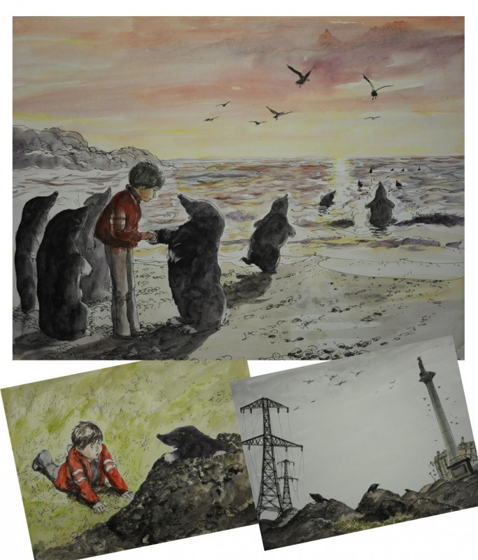
JACKANORY BBC TV The Bionic Moles Original Artwork
Author Clare Moseley, Artwork by Gareth Floyd
Unpublished
£1500.00
Offered by Andrew Cox
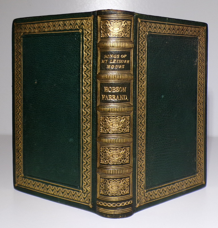
SONGS OF MY LEISURE HOURS
Martha Sophia Hobson Farrand
Matlock Derbyshire Published Poetry
£85.00
Offered by Andrew Cox
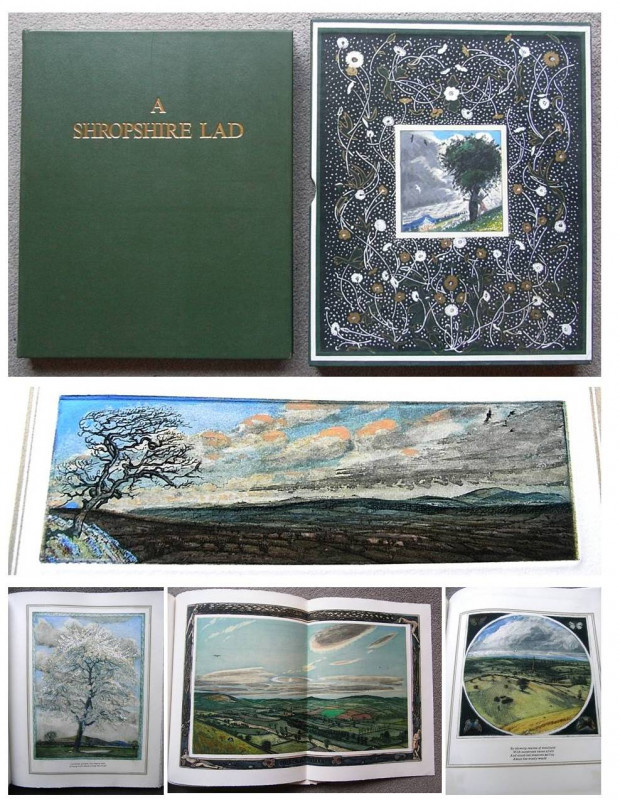
A SHROPSHIRE LAD with Forty Fine Etchings by PIERS...
A E Housman
the Shorthorn Press
£2750.00
Offered by Andrew Cox
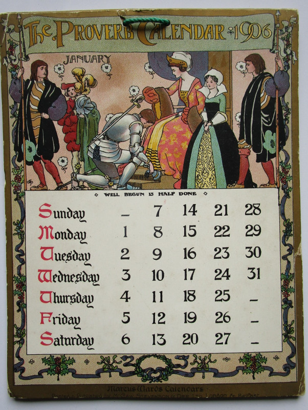
THE PROVERB CALENDAR 1906
Marcus Ward Calendars
McCaw Stevenson & Orr Ltd
£45.00
Offered by Andrew Cox
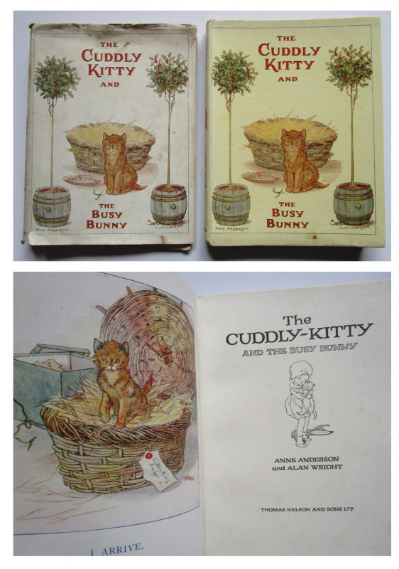
Anne Anderson and Alan Wright
THE CUDDLY KITTEN AND THE BUSY BUNNY
WITH THE RARE DUSTJACKET
£65.00
Offered by Andrew Cox

THE SECRETS OF AN ELECTRIC TRAM
W. Kaye Dunn, B.A.
The National Sunday School Union
£55.00
Offered by Andrew Cox
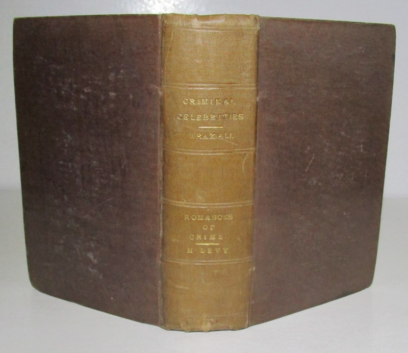
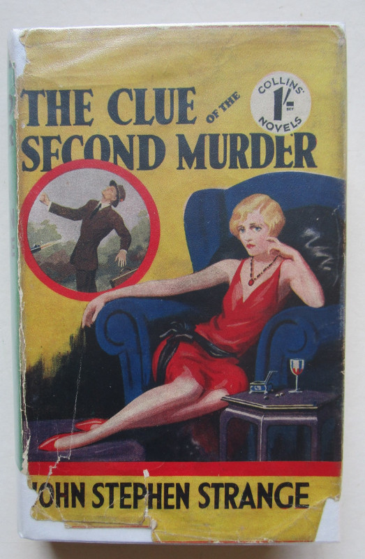
ROMANCES OF CRIME & CRIMINAL CELEBRITIES
SHERLOCK HOLMES INTEREST
Cameron and Ferguson, W. Kent and Co.
£750.00
Offered by Andrew Cox
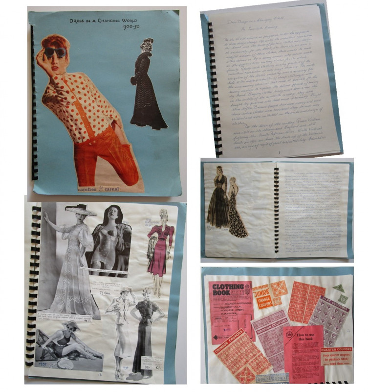
DRESS IN A CHANGING WORLD 1900-1950
Yolande A. Edwards
Manuscript Book ~ Dress Design in the Twentieth Century
£65.00
Offered by Andrew Cox
Friends of the PBFA
Please email info@pbfa.org for more information