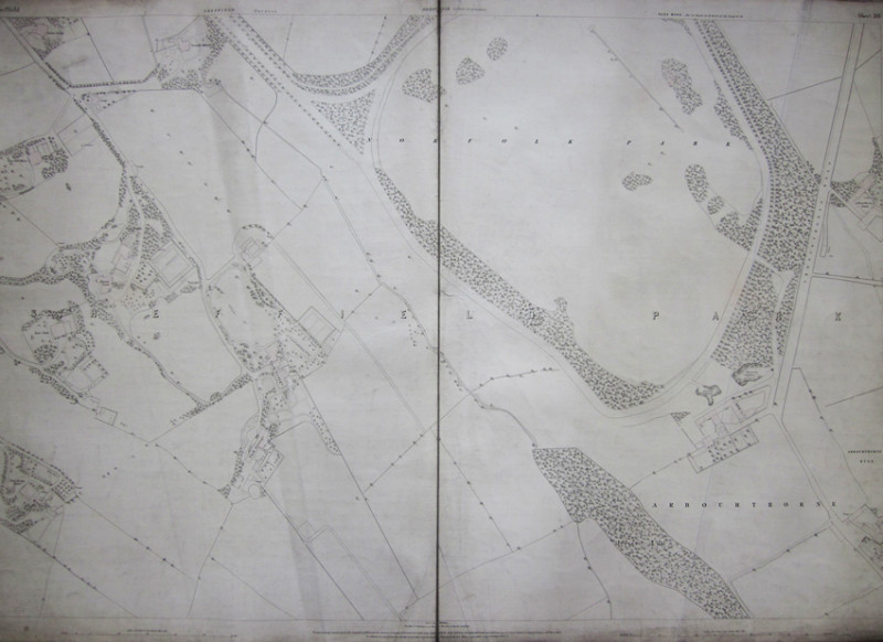
SHEFFIELD 1849 Ordnance Survey Map 5 feet to the mile. SHEET 36 Sheffield Park Ward - Arbourthorne
Book Description
Other books
If you liked the book you've just seen, you might be interested in other books from the same dealer below.
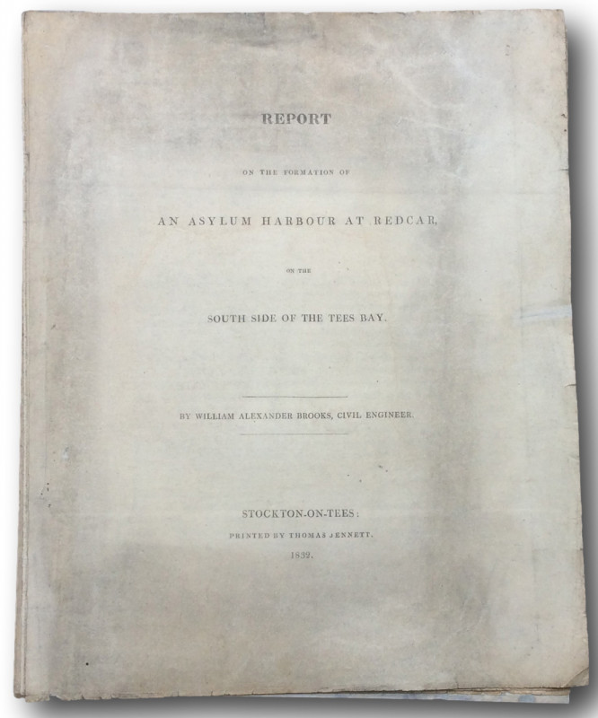
REPORT On the Formation of an Asylum Harbour at Re...
BROOKS,William Alexander [Civil Engineer]
Stockton on Tees. Printed by Thomas Jennett 1832.
£50.00
Offered by John L Capes
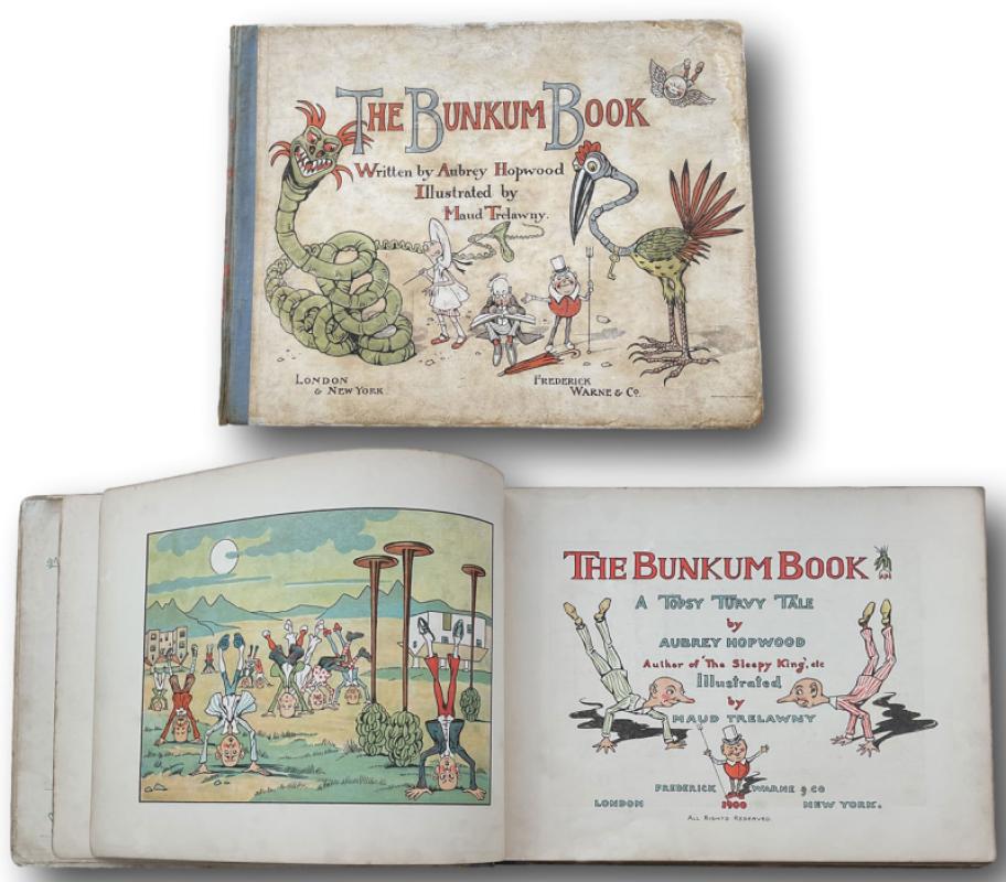
THE BUNKUM BOOK A Topsy Turvey Tale.
HOPWOOD Aubrey(1863-1917) and TRELAWNY Maud (Illustrator)
LONDON Frederick Warne & Co 1900
£150.00
Offered by John L Capes
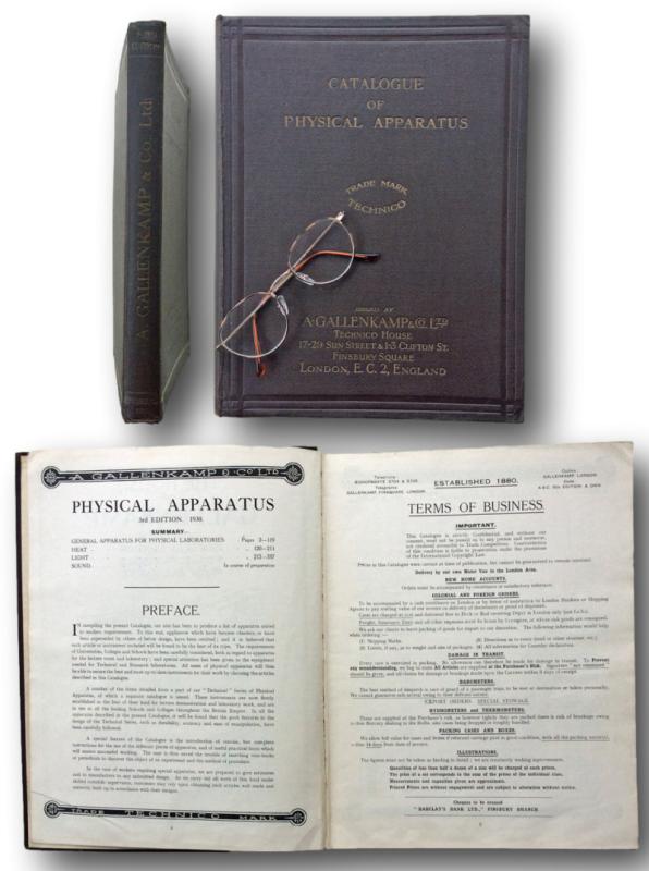
CATALOGUE OF PHYSICAL APPARATUS Third edition 193...
A.Gallenkamp & Co., Ltd.
LONDON:The House of Gallenkamp 17-29 Sun St & 1-3 Clifton St Finsbury Square 1930
£75.00
Offered by John L Capes
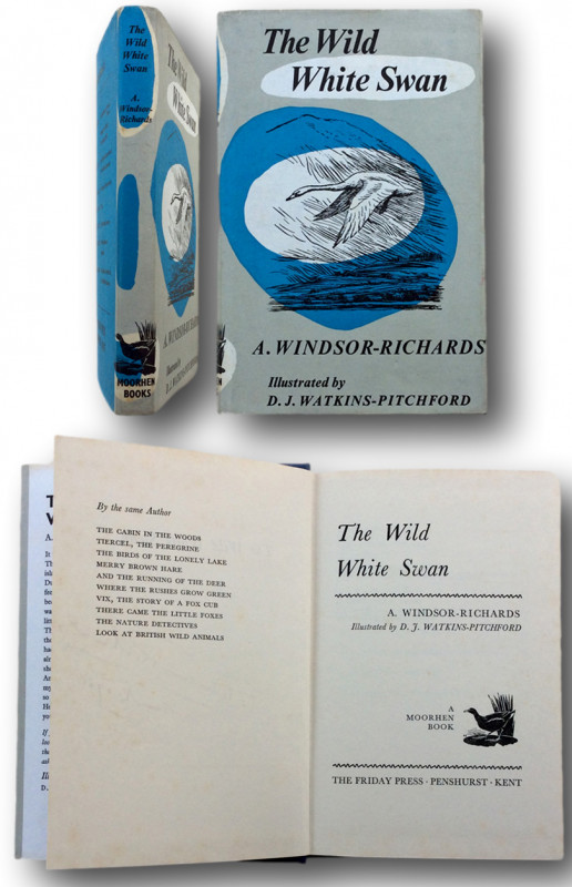
THE WILD WHITE SWAN illustrated by D.J.Watkins-Pit...
WINDSOR-RICHARDS, A.
MOORHEN BOOKS.The Friday Press. Penshurst, Kent 1965
£225.00
Offered by John L Capes
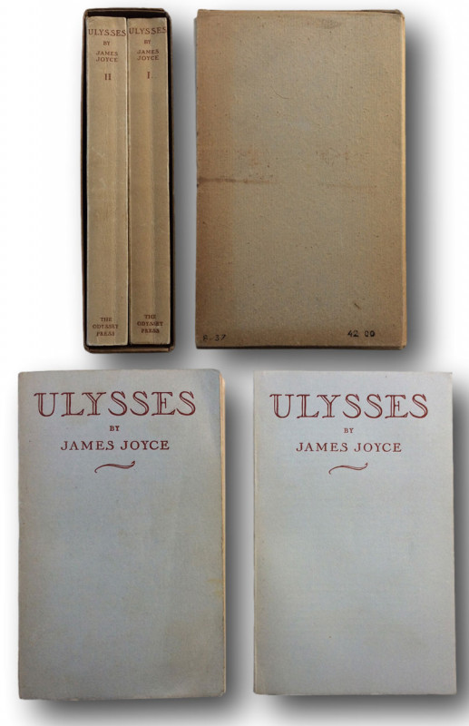
ULYSSES by James Joyce in two volumes
JOYCE, James
Hamburg THE ODYSSEY PRESS. 1935
£200.00
Offered by John L Capes
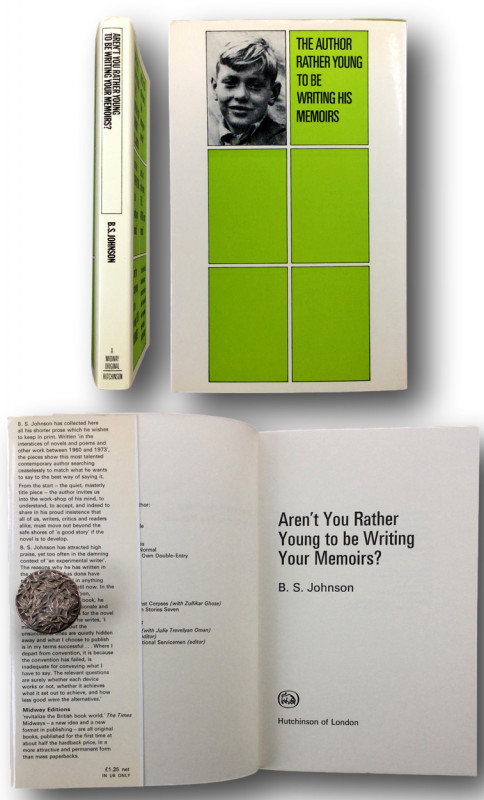
AREN'T YOU RATHER YOUNG TO BE WRITING YOUR MEMOIRS...
B.S.JOHNSON (1933-1973)
Hutchinson of London 1973
£30.00
Offered by John L Capes
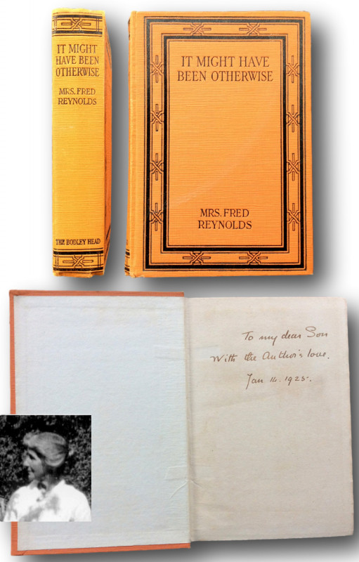
IT MIGHT HAVE BEEN OTHERWISE.
REYNOLDS, Mrs Fred. pen name of Amy Dora Reynolds 1860-1957 aka Amy Dora Percy Williams
London.John Lane The Bodley Head.1925
£100.00
Offered by John L Capes
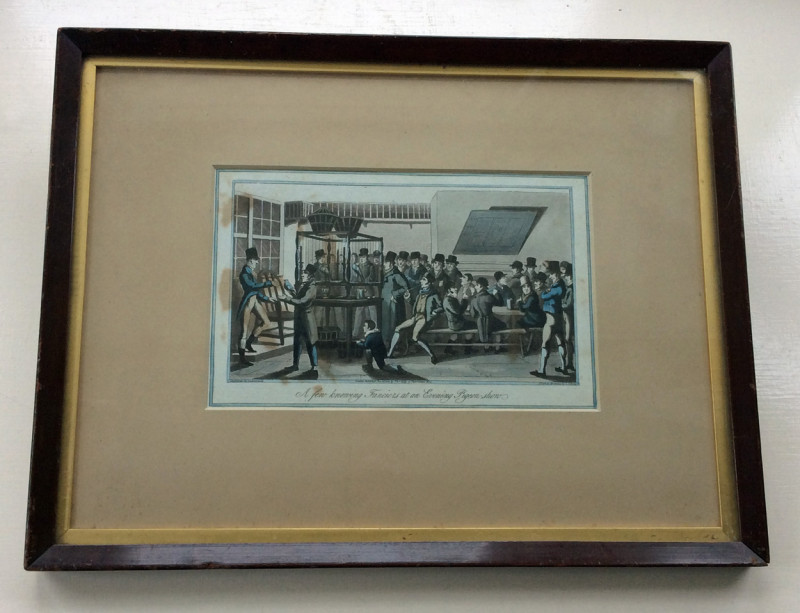
" A few knowing Fanciers at an Evening Pigeon-show...
Samuel Alken [1756-1815 ]
London:Thomas Kelly 17 Paternoster Row. January 26th 1823
£95.00
Offered by John L Capes
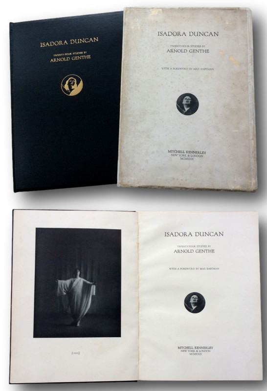
ISADORA DUNCAN Twenty-four studies by
GENTHE Arnold. Max Eastman (Forword)
New York & London Mitchell Kennerley 1929
£200.00
Offered by John L Capes
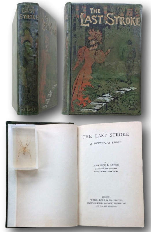
THE LAST STROKE - A Detective Story.
LYNCH, Lawrence L. [pseud of Emma Murdock Van Deventer 1853-1914 ]
LONDON: Ward Lock & Co Ltd. [1897]
£55.00
Offered by John L Capes
Friends of the PBFA
Please email info@pbfa.org for more information