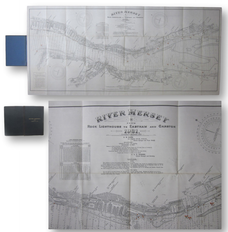
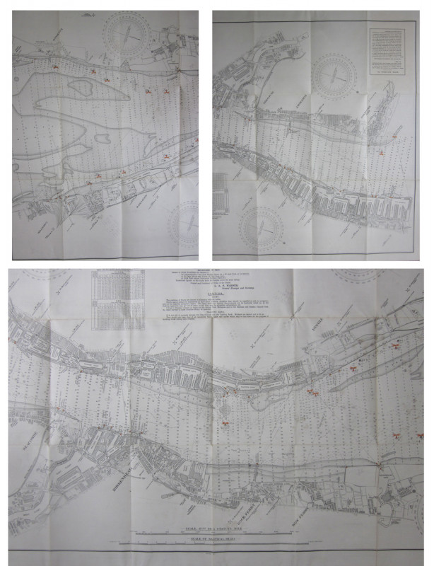
River Mersey from Rock Lighthouse to Eastham and Garston 1931corrected to December 1934

Book Description
Other books
If you liked the book you've just seen, you might be interested in other books from the same dealer below.
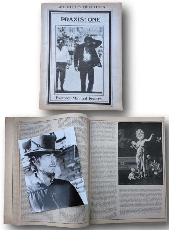
PRAXIS:ONE. Existence, Men and Realities.
Stephen Pickering [editor]: Bob Dylan et al.
Menlo Park Berkeley.California:No Limit Publications
£80.00
Offered by John L Capes
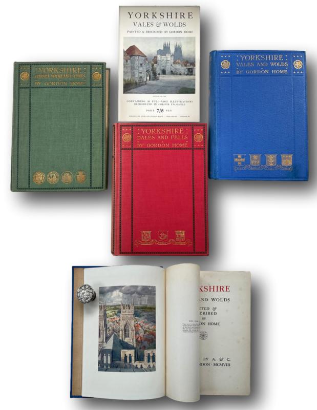
YORKSHIRE The set of 3 volumes DALES & FELLS / VAL...
GORDON HOME (Gordon Cochrane Home 1878-1969)
London: A & C Black 1906/7/8
£75.00
Offered by John L Capes
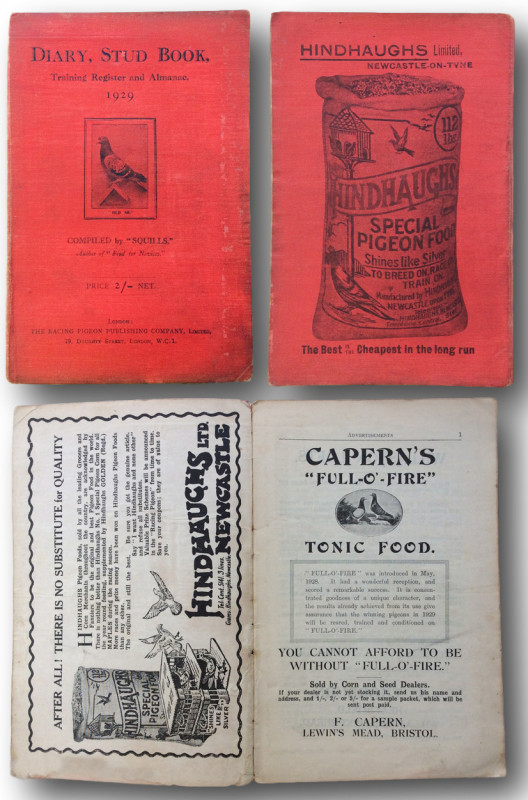
Diary, Stud Book, Training Register and Almanac 19...
" SQUILLS" compiler
LONDON The Racing Pigeon Publishing Company Ltd 19 Doughty St. WC1.
£80.00
Offered by John L Capes
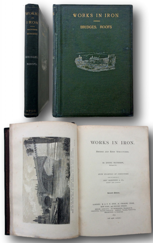
WORKS IN IRON. Bridge and Roof Structures.With exa...
MATHESON Ewing [1814-1917]
London: E.& F Spon 48 Charing Cross 1877
£250.00
Offered by John L Capes
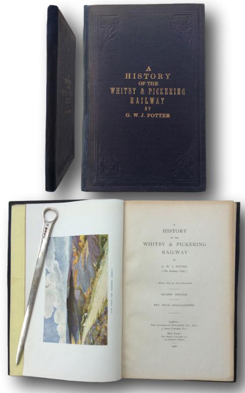
A History of the Whitby & Pickering Railway.
POTTER,G.W.J. [The Railway Club]
LONDON. The Locomotive Publishing Co Ltd. 1906.
£95.00
Offered by John L Capes
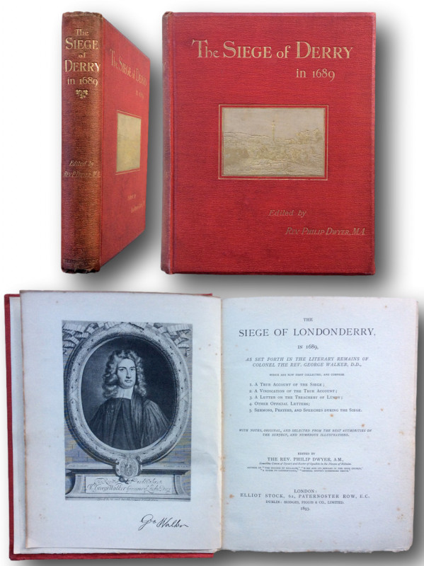
THE SIEGE OF LONDONDERRY, In 1689 As set forth in...
DWYER, Rev Philip M.A
LONDON; Elliot Stock 62 Paternoster Row. DUBLIN Hodges Figgis & Co Ltd 1893
£90.00
Offered by John L Capes
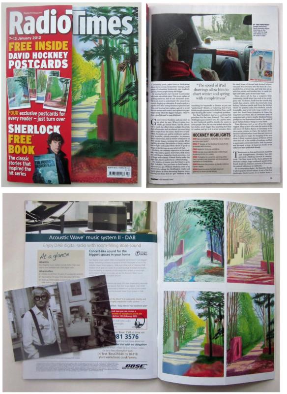
David Hockney : Radio Times interview 2012
Preston, Ben. HOCKNEY, David
London January 2012.
£23.00
Offered by John L Capes
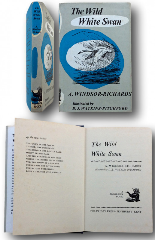
THE WILD WHITE SWAN illustrated by D.J.Watkins-Pit...
WINDSOR-RICHARDS, A.
MOORHEN BOOKS.The Friday Press. Penshurst, Kent 1965
£225.00
Offered by John L Capes
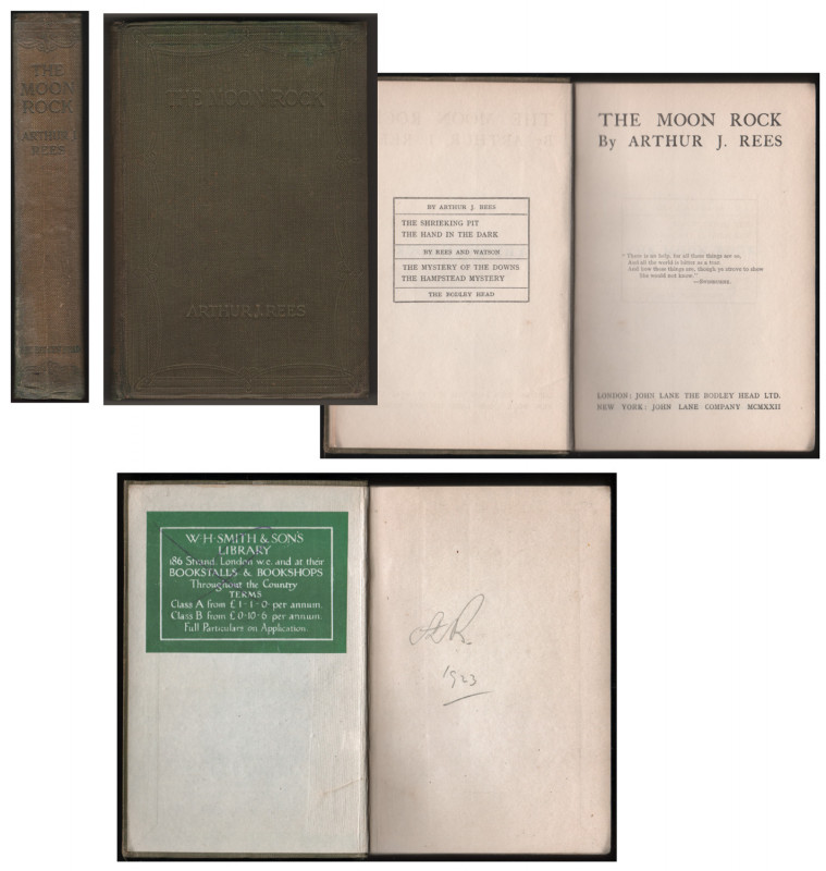
THE MOON ROCK.
REES, Arthur J. [Arthur John Rees 1872-1942]
LONDON: John Lane The Bodley Head Ltd 1922
£30.00
Offered by John L Capes
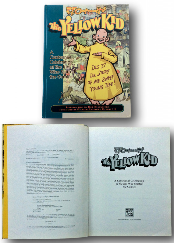
R.F.OUTCAULT The Yellow Kid: A Centenial Celebrat...
OUTCAULT Richard Fenton (Bill Blackbeard introduction)
NORTHAMPTON Massachusetts Kitchen Sink Press 1995
£90.00
Offered by John L Capes
Friends of the PBFA
Please email info@pbfa.org for more information