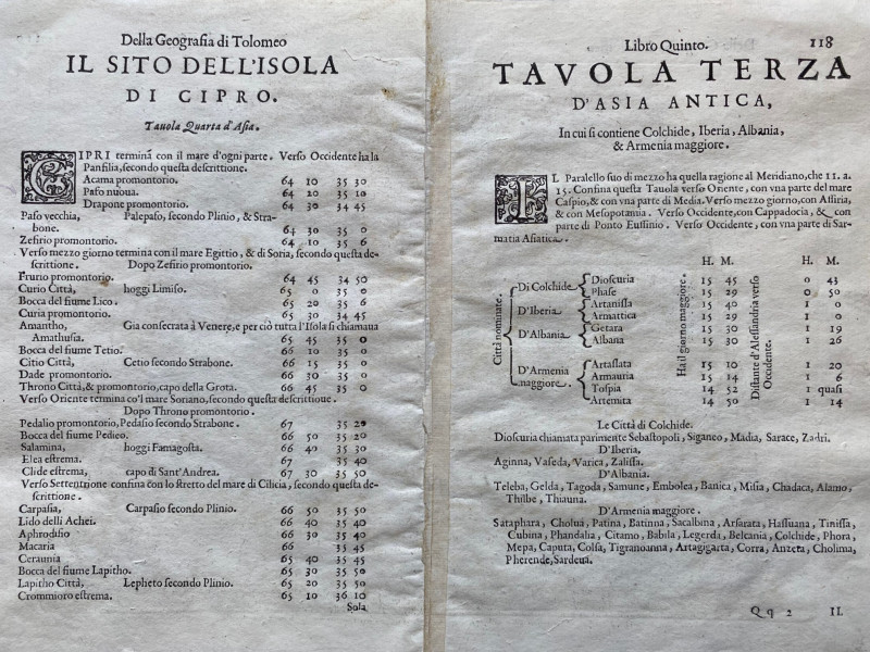
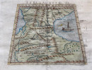
Ptolemy Map of the Caucasus Region: Armenia and part of Russia between the Black and Caspian Seas

Book Description
Ptolemy Map of the Caucasus Region: Armenia and part of Russia between the Black and Caspian Seas from Ptolemy’s Geography Book V, published Venice circa 1600. On paper size 26 by 19 cm. The image is wider at the bottom (24 cm.) and narrow at the top (17 cm.) because of the projection used in the map. Hand-coloured. Heights are shown in a stylised manner and place names are in Latin. Text to the reverse does not affect the image. Good to VG condition.
Author
Ptolomey
Date
1600
Publisher
Pirckheimer
Condition
Good to VG
Other books
If you liked the book you've just seen, you might be interested in other books from the same dealer below.
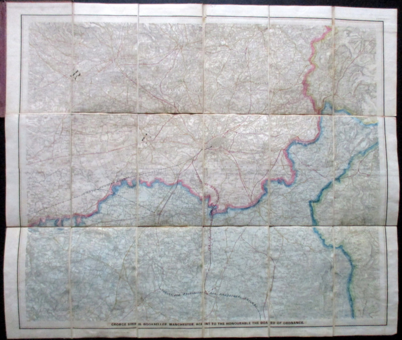
Ordnance Survey Map of Manchester & Neighbourhood...
Simms
Ordnance Survey
£65.00
Offered by Arthur Hook
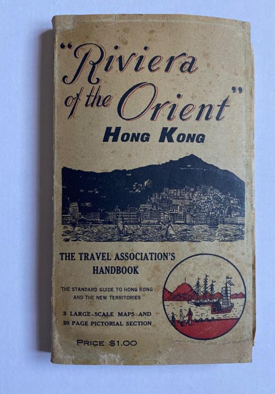
Hong Kong Riviera of the Orient
Hong Kong Travel Association
Hong Kong Travel Association
£775.00
Offered by Arthur Hook

Doncaster Races by Great Northern Railway 1870
Anon
Great Northern Railway
£45.00
Offered by Arthur Hook

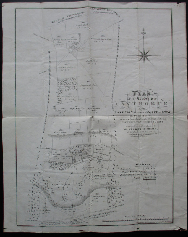
Plan of the Lordship of Caythorpe in the East Ridi...
Madeley
Madeley
Reserved
Offered by Arthur Hook

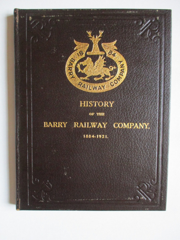
History of the Barry Railway Company 1884-1921
Rimmell
Barry Railway Company
£165.00
Offered by Arthur Hook
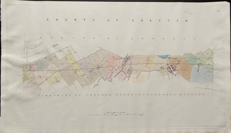
Map of the Parish of Cheadle with Townships of Che...
Rennie
Arrowsmith
£35.00
Offered by Arthur Hook
Friends of the PBFA
For £10 get free entry to our fairs, updates from the PBFA and more.
Please email info@pbfa.org for more information